Posts Tagged ‘mapping’

casastristes en summerLAB camp

Wednesday, August 6th, 2008

Esta semana del 4 al 9 de agosto Hangar y la Laboral organizan el SummerLAB Camp en Gijón. Es un encuentro de artistas, estudiantes y profesionales de la creación audiovisual para potenciar la interconectividad de la escena digital española. Se llevaran a cabo talleres de software y hardware libre, charlas sobre creación, “brainstorming” de futuros proyectos etc, echa un vistazo al wiki para ver los proyectos que se están desarrollando allí.
(more…)

SVG with Processing for mapping data

Monday, March 24th, 2008

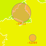
casastristes.orgFor casastristes.org we are making different visualizations of the housing situation in Spain. Also Java is a pain in the ass on the web, in two of them we are using Processing comparing new inhabitants with newly constructed houses and free real estates per provinces. In the following article I show the advantages of using SVG graphics when mapping information.

(more…)

Mapping lat/lon values with JavaScript

Wednesday, March 19th, 2008

Googe Maps loads about 400 kByte for each visit to casastristes.org. Sometimes I prefer to implement a static map instead but still using latitude and longitude values for mapping the places. In the following example I show how to convert lat/lon values to x/y coordinates for the use on a static map.

(more…)