Archive for the ‘maps’ Category

Linz pflückt: Fruits for free

Sunday, May 26th, 2013

simple_leaf_xxhdpiLinz Pflückt shows more than 2000 public fruit trees in the city of Linz. The basic data comes from the open data portal which was launched as part of the Open Commons Region Linz. The dataset contains information on species, genus, tree height, etc. which we extended with information such as maturity and fruit category.

The fruits of the trees are freely available public domain, which may be picked and eaten by every person! Look at the trees and enjoy the taste of the fruits!

You as fruit fan are invited to evaluate the fruits, comment on the trees and to enrich them with photos. With your submissions, the project is gaining usability and usefulness.

Linz Pflückt is also available as app for Android devices. Owners of other phones can use the mobile version of the website.

The project was built using free software frameworks as OpenStreetMaps, leafletjs and WordPress.
OpenStreetMap con Drupal y WordPress

Wednesday, July 7th, 2010

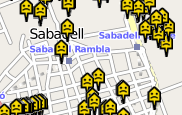
casastristes sabadellHace poco mostré como utilizar OpenStreetMap a través de la librería de JavaScript Openlayers. Ahora miramos como incrustarlo dentro de gestores de contenidos como Drupal y WordPress.

(more…)

OpenStreetMap con Openlayers

Tuesday, May 18th, 2010

osmOpenStreetMap es cada vez más una potencial alternativa a Google Maps, sobre todo en proyectos que dan importancia al uso de licencias libres. En seguida mostraré el uso de OpenStreetMap en páginas estáticas, más adelante lo presentaré posibilidades de usarlo con WordPress y Drupal.
Openlayers es la forma más sencilla de incrustar mapas de OSM en una web estática cualquiera. Aquí mostraré una forma rápida y sencilla de enlazarlo con una API de locación geográfica.
(more…)

“Un paisatge diferents mirades” en 3D

Tuesday, June 10th, 2008

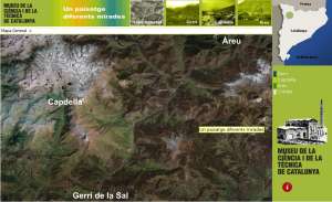
Un paisatge diferents miradesFinalmente esta online la versión 3D de “Un paisatge diferents mirades: Gerri de la Sal, Capdella i Àreu”. Esta desarrollado sobre el software Geoshow de la empresa Geovirtual que permite visitar Cataluña en tres dimensiones – hasta ahora solamente bajo Windows pero con la versión 3 también lo prometen para Linux. Esta ruta forma parte del sistema territorial del mNACTEC y es un prototipo para futuros desarrollos.

cityzoom: mini module showing locations on gmap

Thursday, June 5th, 2008

As participation on our project casastristes.org is growing and people start to incorporate our empty houses map into their sites we now offer a faster way to directly zoom to a city. I wrote a little Drupal module which offers a block on the main page showing a list of available cities. Right now cities are hardcoded and not configurable and maybe it would be nice to integrate that feature in the gmap module but meanwhile I publish the module here. You can see it in action in the right column at the frontpage at casastristes.org named cityzoom.

Here you can download the module: cityzoom
Just put it into your modules directory and activate it, keep in mind that it needs gmap module to work.

SVG with Processing for mapping data

Monday, March 24th, 2008

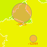
casastristes.orgFor casastristes.org we are making different visualizations of the housing situation in Spain. Also Java is a pain in the ass on the web, in two of them we are using Processing comparing new inhabitants with newly constructed houses and free real estates per provinces. In the following article I show the advantages of using SVG graphics when mapping information.

(more…)

Mapping lat/lon values with JavaScript

Wednesday, March 19th, 2008

Googe Maps loads about 400 kByte for each visit to casastristes.org. Sometimes I prefer to implement a static map instead but still using latitude and longitude values for mapping the places. In the following example I show how to convert lat/lon values to x/y coordinates for the use on a static map.

(more…)

Las casas vacías tienen acogida: casastristes.org

Thursday, November 29th, 2007

Por fin las casas vacías tienen acogida: tenemos en marcha una primera versión de casastristes.org. Esta basada en el desarrollo que ha hecho Daniel Remeseiro para casasvacias.org hecho en Drupal. Queremos animar a la gente a participar en el proyecto y así hacer más visible el problema de las casas vacías en el estado español. La página esta en versión BETA ya que no hemos hecho suficiente pruebas y todavía estamos trabajando sobre algunas visualizaciones. Una vez terminado esta fase empezaremos a distribuir el proyecto.

banner colaboración