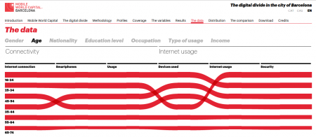
Barcelona urban history in 26 interactive maps
Monday, July 4th, 2016The Historic Charter of Barcelona is a tool to explain the history of the city through the cartographies that describe it. It contains 26 maps that have been drawn from texts, historical cartographies, archaeological maps, modern cartography and contemporary digital maps. A committee of historians specialized in the various historical eras have cross-checked and corrected the documents under the direction of the Barcelona City History Museum (MUHBA).
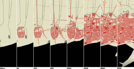
The project was done by 300.000 km/s, my part was the configuration of the mapping server and the programming of the web front end. The backend consists of Mapnik rendering map tiles which get served by TileStache. On the frontend we are running OpenLayers using raster tiles but also geojson layers. (more…)